News #8
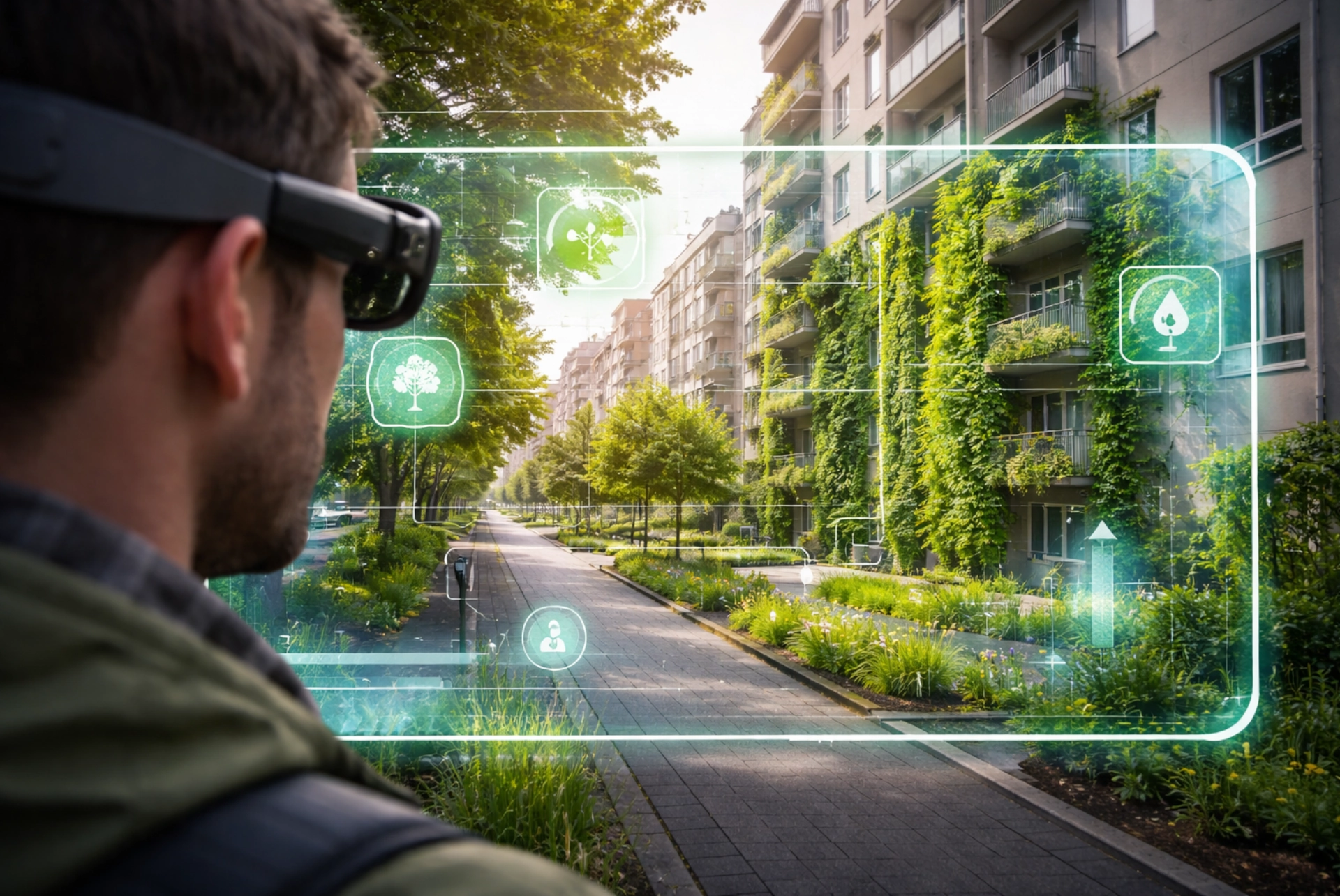
Figure: Own image (AI generated).
NEWS
2026-03-23
Associated Partners in Action - What can we learn from technology in climate change adaptation?
In the RESIST project we are working with XR and Augmented Reality solutions as new tools to support communication, dialogue, and citizen engagement in climate change adaptation. One example is the work carried out in Smedegade in Horsens, where a location-based AR application has been developed.
Horsens is vulnerable to both storm surges and cloudburst events, partly because the city is located in a low-lying coastal area. The municipality’s approach connects climate adaptation with urban life: Water must be managed and guided efficiently through the city’s systems while also creating recreational value. At the same time, surface runoff in urban areas can transport pollution, which affects the possibilities for recreational use of surface water.
The Smedegade case was selected because the area represents a complex urban space with many dense, impermeable surfaces and challenging topography. This makes it highly relevant for working with Nature-Based Solutions (NBS). The AR application visualizes potential NBS measures such as green walls and trees directly within the urban space.
The goal is not to present a finished plan, but to give citizens and stakeholders a concrete and understandable experience of what a possible future urban space could look like. This makes it easier to discuss solutions, priorities, and local considerations.
Presentation of the AR application available on the GINA YouTube channel: VIDEO